Why Geosetta?
Making public subsurface data accessible, standardized, and useful for every geotechnical professional.
- Non-profit structure ensures independence and serves the profession, not shareholders
- 750,000+ boring logs from public agencies worldwide
- ML-powered predictions provide preliminary subsurface understanding
- Open format enables sharing and collaboration
- Not a substitute for site-specific investigation
Research & Publications
Geosetta was founded on research conducted for the Maryland State Highway Administration. Below are the foundational reports and subsequent publications that have contributed to its development.
Foundational Research
Machine Learning Techniques for SPT Based Geotechnical Subsurface Modeling
Established the machine learning methodology that forms the core of Geosetta's predictive capabilities, demonstrating how neural networks can effectively predict subsurface conditions from SPT data.
View ReportDeveloping a GIS-Based Platform for Managing Boring Log Requests and Geotechnical Data
Laid the foundation for Geosetta's platform architecture, outlining the need for a centralized system for managing and sharing geotechnical data across agencies.
View ReportPublications Using Geosetta
A Methodology for Comparison of Algorithm-Based Subsurface Predictions with Geotechnical and Geophysical Data
Validates Geosetta's AI-based predictions by comparing them with high-quality geophysical data from MASW testing and traditional geotechnical boring data at Penn State. Investigates direct strata delineation comparison and Site Class computation based on VS30.
Citing Geosetta
If you use Geosetta in your research or professional work, please cite it as:
For specific datasets, include the data source (e.g., VDOT, MDOT, MnDOT) and access date in your citation.
Have you published research using Geosetta? We'd love to feature your work — reach out at research@geosetta.org.
Education & Outreach
Geosetta is being integrated into undergraduate and graduate geotechnical engineering curricula to give students hands-on experience with real-world data and modern site characterization workflows.
In the Classroom
Virginia Tech — Foundation Design Course
"I have integrated Geosetta into the undergraduate foundation design course I teach, demonstrating it as part of site characterization alongside aerial photography and geologic maps. I created a homework to give students experience with desktop studies for a real bridge reconstruction project in Roanoke."
Students use Geosetta to analyze real boring log data and develop geotechnical profiles for infrastructure design projects.
View Homework AssignmentEducational Resources
Understanding Standard Penetration Testing (SPT)
Learn proper SPT drilling technique, common mistakes to avoid, and safety best practices in this field demonstration video.
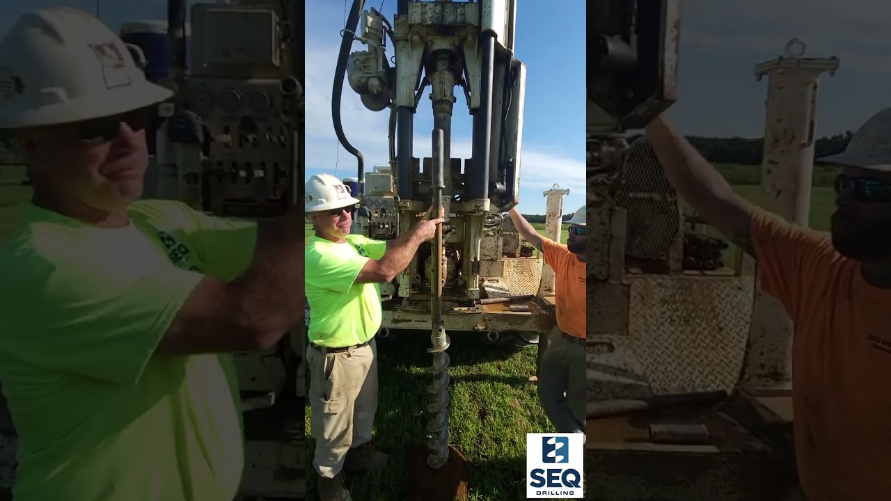
Watch on YouTube
Teach with Geosetta
Are you an educator interested in integrating Geosetta into your curriculum? We provide:
- Free access to all data and tools
- Support for developing course materials
- Real-world datasets for student projects
- Opportunities to collaborate on educational research
Contact us at education@geosetta.org to discuss how Geosetta can support your teaching.
Data Concerns and Removal Requests
Geosetta is committed to responsible stewardship of the data it aggregates. If you are a data owner or source and would like to request correction or removal of data, or if you have concerns about how data is represented, please contact us at data@geosetta.org. We review all such requests and will correct or remove data where appropriate.