The public subsurface.
1 million+ boring logs from public agencies worldwide — searchable and ML-enhanced.
Start ExploringBoring logs from 35+ state DOTs, all in one place
ML-predicted soil profiles at any unmapped location
Generate site reports with geology, soils, and nearby borings
Download DIGGS-standard data files instantly
Free API access for research and public agencies
A nonprofit, built for the profession

Public Agencies
It is our mission to provide our profession with historical public geotechnical data.

Public & Private Partnerships
Help us provide these tools to our profession by donating data or resources.

Open Data
Geosetta assists with the development and deployment of DIGGS. Our data is open, interchangeable, and exportable.
Sponsors

Partners
Application Development & Machine Learning
Contributing sources: 1 million+ boring logs and growing
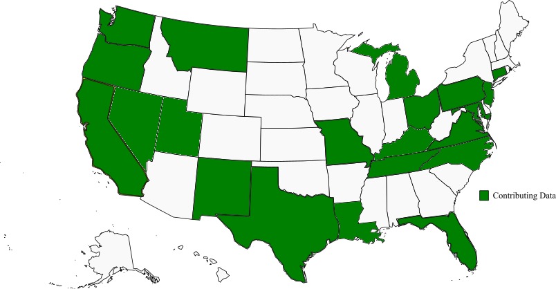
Data Contributors


Academic Partners


